Wednesday, March 26, 2014

Eggs, Eggs, Eggs!

With the (slightly) warmer and longer days the chickens have started laying eggs like crazy.

I'm getting about 9 to 13 eggs a day. All the breeds are laying now, even the little Sultans (they are laying the smaller white eggs shown). 

So, when I got all these hens just what was I thinking? 

A coworker is buying a lot of my eggs, but he's on vacation this week. I'm looking forward to when he returns so I can offload my egg glut.

Meanwhile there's omelets, quiche, crepes, hardboiled, fried eggs, pancakes, deviled, egg salad, breakfast burritos, poached, eggs benedict...

Monday, March 24, 2014

Glass Buttes

Not long after we moved here we found a book called "Bend, Overall" by Scott Cook.  It's a great book for exploring the multitude of things to see in Central Oregon. It has great descriptions, pictures, and directions.

On my last days off we decided to visit #9 in the book, Glass Buttes. It's an area full of obsidian that people are allowed to collect, unlike in the Newberry Caldera's obsidian flow where it is stricktly illegal to collect obsidian.

The directions were right on, advising that the turn off is a road at the 77 mile marker of Highway 20. At the road we found it marked with a giant wooden arrow. (If you look closely in the background of the picture you can see the 77 mile post marker under the back end of the arrow head where it joins the shaft.)

2.2 miles down the road is a campground, where we were surprised to find had quite a few campers. They looked like "permanent" campers. Anyway, as the book described at the campground we took a sharp left until the road split. Right there we parked and started looking around.

The road was actually sparkly from the obsidian bits. I tried to get a good picture but it just didn't show up.

The ground was littered with bits of obsidian, some bigger than others.


We had our hammers, gloves, and eye protection and went to banging on rocks.

Here is a piece I split. You can see how it just looks like a dark rock until it it is split, then the shiny glassiness  shows through.

I guess these ones with the reddish brown in them are called mahogany obsidian.

Here's a shard that was broken off. Look at how you can see my finger on the other side.

This was not staged! We actually found this wildflower poking up next to a shiny piece of obsidian.

We gathered some interesting pieces and I found a good sized chunk of unbroken obsidian to take home. 

Sunday, March 23, 2014

Vicki's Afghan

My last afghan I made was another of the "Crocheted Shades". I made this one for my friend Vicki who recently bought a new house at the beach. Coincidentally it is also her birthday at the end of this week. 

I asked her what colors her new house was going to be and the answer was blues.

Just for a little contrast I added one shade of dark tan. It's Red Heart "Cafe Latte".

Though it looks in the photos like there are two blacks in reality there is a black and a dark blue with a shimmer. If you enlarge this picture you might see a little of that shimmer.

Anyway, Vicki loved the afghan and sent me this picture of it in her new house. You can see the colors are very close to the chair colors and she's got the blue samples going on the wall behind.

Maybe one of these days I'll actually be able to have enough time off to go in person and see it in her house.

Friday, March 21, 2014

Sahalie Falls and Clear Lake

The final two stops on our trip home were Sahalie Falls and Clear Lake.

First was Sahalie Falls.

This one was so full of water I had to be very careful with my camera. The mist was very heavy. If you were to stand in one spot too long you would soon be wet! 

Here's a couple views from the top. 


Getting to this point made me a little nervous. 

It wouldn't be hard to get a little closer and accidentally fall or slip. And then it would be all over! Over the top of the falls, that is.

After that we stopped at Clear Lake, just a few short yards up the McKenzie Highway from Sahalie Falls.

Hard to tell here, but that is a Barrow's Golden Eye Duck.

There he is in the middle of the lake, I'm sure enjoying the view, as we are. 

A big covered picnic area. There is a fireplace and two large tables inside.

A plaque in the fireplace I believe has a 1937 date on it. It's rather worn and faded and next to impossible to read.

When the weather gets a little warmer we'll have to revisit the area for a real picnic. 

I'm looking forward to it!

Sunday, March 16, 2014

Carmen Reservoir and Koosah Falls

After checking out the Smith Reservoir, Smith River, Trail Bridge Reservoir, and the Trail Bridge Power Plant we continued on our journey and pulled over just a little further up. We went to the Carmen Reservoir.

This photo was taken from the bridge going over the McKenzie River from upstream.

And here is the tiny Carmen Reservoir. You can see the river inlet at the left. This reservoir is only about 32 acres.

After snapping a few pictures we headed back out onto the McKenzie Highway and took the next turn to see the Koosah Falls.

From the parking lot was a nice trail that headed into the forest towards the falls. It was only a short walk and there it was. Here are a couple pictures from the top of the falls.  


 You can see how full the river is now.

Can you just imagine the power rushing by?

The top of the falls is to the right, not visible in this shot looking downstream. You can barely see the mist generated by the falls.

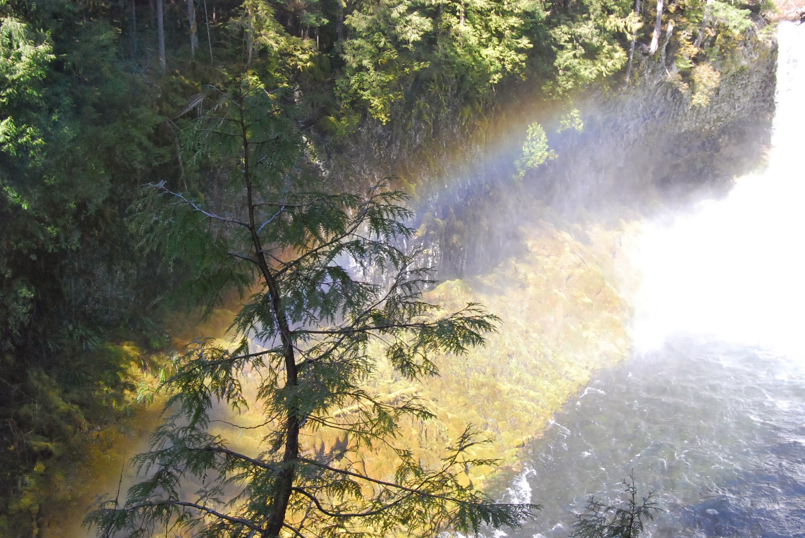
From the top we followed the trail to get a good vantage point of the whole falls.

See the rainbow?

I tried using a couple of different speed settings on my camera but to be honest I can't really tell a big difference. 


This is the trail to the landing to get the best view of the falls.


Here I tried to get a good picture of the rainbow in the mist.

This is a good map of the various reservoirs and falls along this stretch of the road. Unfortunately I couldn't get a good picture of it.


Friday, March 14, 2014

Trailbridge Reservoir, Power Plant, And Smith Reservoir

This week I happened to get five days off in a row (not good for getting hours at work...) and we took advantage of that to visit our friends in Roseburg and then stop at my SIL outside of Eugene for a night. 

After our fabulous visits we decided to stop at a few of the falls along the way home. The first place we stopped at was the Trailbridge Power Plant and the Smith Reservoir. 

There's no falls at this particular spot but it was a very nice and private area. 

We had to drive by the power plant under this one lane road winch platform contraption. If you look closely at the bottom you can see it is on a sort of track so it can be moved back and forth, presumably to service parts of the power plant. 


When we stopped to take a closer look at the power plant this gate was open and I took a couple steps down the path.  All the gates were open but I got a little nervous since it's not in my nature to go against the rules. I went back out and just took the pictures from outside.

One of the interesting things was this ever-running faucet just outside the gate.

This is the power plant from across the way. If I had gone ahead and been the terrible lawbreaker I could have been I would have been at the path on the bottom near the water.

Eventually we made our way past the powerhouse and back through the canyon to the reservoir dam. It reminded me of a place in Germany we used to visit on occasion. It was called the Felsenmeer and we used to climb from the bottom to the top and back again. There were paths on either side for the less adventurous and the people who couldn't leap from boulder to boulder. As I recall there was a cafe at the top. But anyway, the rocks on the dam were not as large.


And here is the Smith Reservoir. It was so calm and quiet. Check out the perfect mirror image.


On the way back out we stopped at one of the camp areas and took a trail to see the Smith River below.

The trail is part of the McKenzie River Trail.

Downstream.

Upstream.

On the bridge.

And on the way out we wondered if this might be the only surviving pay phone booth in the Western United States??